


The Georgian Military Road hides many secrets and exciting stories, it is described in several literary works of Russian classics (Griboyedov, Lermontov and Pushkin traveled along it), and in Georgia, a trip along it is a full-fledged excursion, enjoying great popularity. I have traveled along this picturesque road many times, and in the article I will tell you why it is interesting, and what its sights are definitely worth seeing.
Georgian Military Road at a glance
- How long it takes: from Tbilisi to Stepantsminda (Kazbegi) is about 150–160 km, around 3 hours without stops. With stops and the climb to Gergeti it takes the whole day.
- What to see in 1 day: the Zhinvali Reservoir and Ananuri, the confluence of the Aragvi rivers in Pasanauri, Gudauri, the Friendship Arch and Gergeti Church.
- How to go: by your own or a rented car, or by marshrutka from Didube station to Stepantsminda.
- When: all year round, but the weather here is very unpredictable. Snow in April is not unusual, and the first snow can fall as early as October. In heavy snowfall the road is closed, sometimes for several days.
- What car: in dry weather an ordinary car will get to Stepantsminda. But there is snow in April and October too, so in the off-season and in winter it is better to take an SUV. For Juta, the Truso Gorge and the Gveleti waterfalls you need a 4×4 at any time of year.
History of the Georgian Military Road
It is surprising that in this place there was a road in ancient times, as mentioned in the works of the ancient historian Strabo.
So, the Georgian Military Road connects Tbilisi and Vladikavkaz, and is the only land connection between Russia and Georgia. Where does this name come from? At first, this road was called “Alexander’s Way”, and it owes its current name to the military department, to whose care it was entrusted in 1903.
Its length is 208 km, of which 170 km run through the territory of Georgia.
In 1927, regular wheeled traffic began on this road.
At the beginning of the 20th century, it was planned to build a tram line along the Georgian Military Road, however, due to the outbreak of World War I, and then the Great Patriotic War, this plan was never implemented.
Georgian Military Road today
The road is currently in good condition, repaired, except for the section between the Georgian and Russian checkpoints.
The Georgian Military Highway is beautiful at any time of year, but the weather in this area can be very unpredictable. Monitor the road condition online before traveling, sometimes the VGD is blocked due to heavy snowfall.
Remember to take warm clothes, even jackets. The temperature difference between Tbilisi and the mountains can reach more than 20 degrees Celsius! So, when the plains are sweltering, in Stepantsminda, for example, you will wrap yourself in warm sweaters and want to put on a hat.
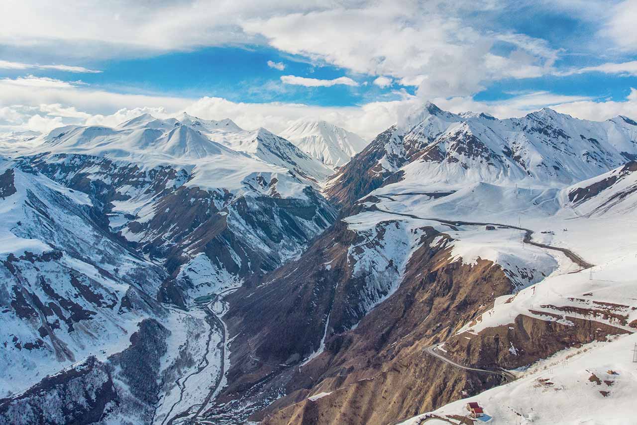
The new Kvesheti–Kobi highway: tunnels and bridges
The road is being seriously upgraded right now. A new 23 km highway with five tunnels and five bridges is being built between the villages of Kvesheti and Kobi. The main 9 km tunnel runs under the Cross Pass — it is the longest tunnel in Georgia. And the country’s biggest arch bridge will hang 166 metres above the gorge, with a length of more than 400 metres.
Why all this: the section between Gudauri and Kobi is the one most often closed in winter because of avalanches. The new highway will bypass it, and the road will no longer have to be closed because of snow. The drive from Tbilisi to Stepantsminda will be cut from about 2.5 hours to 1 hour 45 minutes.
According to the Minister of Infrastructure, the highway will open in 2028. The Friendship Arch and the Cross Pass will stay on the old road, so for the views it is still worth driving that way.
Sights of the Georgian Military Road
If you have only 1 day for GMD, it is best to go to Stepantsminda, if you are lucky with the weather, see Kazbek, climb Gergeti (I strongly recommend it). Along the way, you can make several stops at the main tourist sites – see the confluence of the black and white Aragvi, admire the views from the observation deck of the Friendship Arch. You should not go further than Stepantsminda: you will be very tired if you need to return to Tbilisi on the same day.
When choosing a tour or renting a car, give preference to a car with a high landing. Of course, the main sights of the road can be seen in a regular car, but not in the cold season. And even in the summer, if you want to get to places like Juta, Truso Gorge, Gveleti waterfalls, then you cannot do without a 4×4 car.
Ananuri Fortress and Zhinvali Reservoir
60 km from Tbilisi, on the Aragvi River, there is a huge water reservoir. Despite its artificial origin, it fits harmoniously into the natural landscape. The reservoir is surrounded by velvety green mountains.
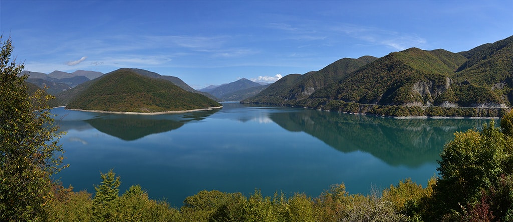
Zhinvali is especially beautiful in autumn (November), when the forested mountains that surround it turn golden and crimson, and because of the low temperature and high humidity, the water turns a bright turquoise. The sky is incredibly blue.
There are many viewing platforms on the section of the road along the reservoir, so you can photograph Zhinvali from different angles.
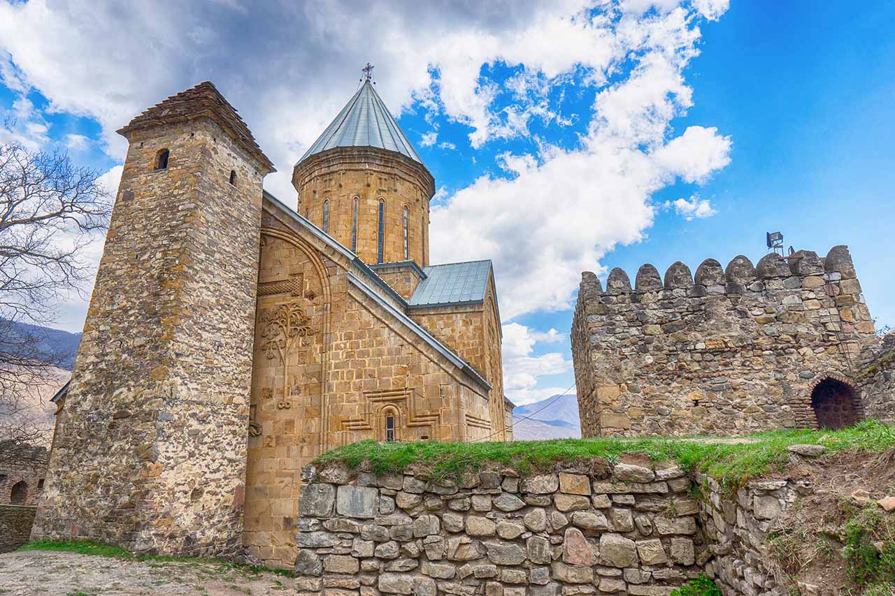
After passing the reservoir, you will see the Ananuri fortress complex. It is impossible not to notice it – firstly, the castle stands on a hill, almost in the middle of the Aragvi gorge, isolated, and secondly, the medieval fortress complex (16th century) stands out sharply against the background of the turquoise waters of the Zhinvali reservoir and the dark green mountains.
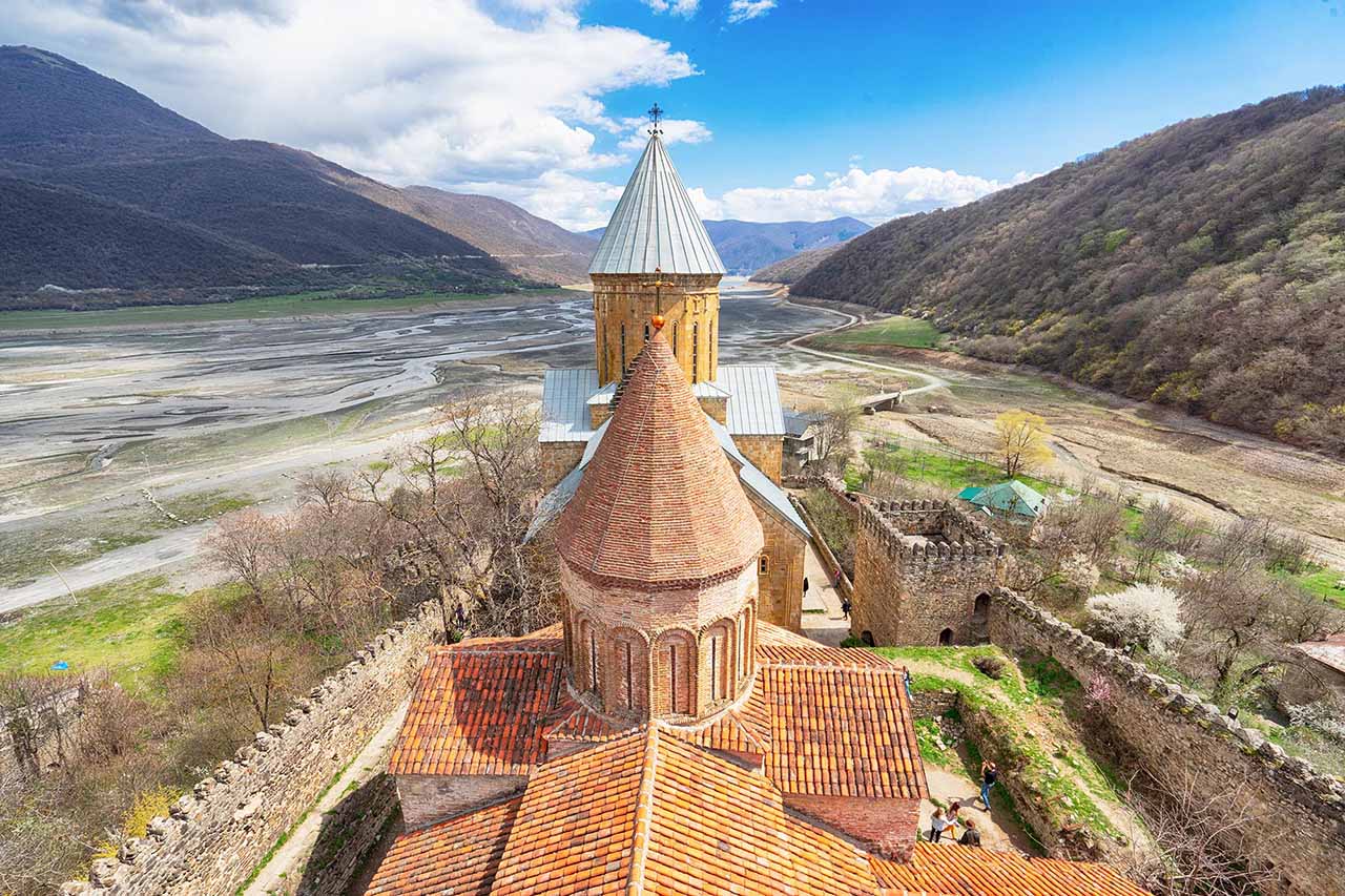
During the period of shallow water in Zhinvali, the bottom of the reservoir in the vicinity of Ananuri is exposed, and during this period one can see an old fragment of the GMR.
Pasanauri and the confluence of the two Aragvi rivers
Coming from Tbilisi, at the very beginning of the village of Pasanauri, you can see a very unusual natural phenomenon: the confluence of two branches of the Aragvi River – the white Aragvi, flowing from the Khevi gorge, and the black – from Pshavi. After the confluence, along some distance of the common branch, a sharp boundary between the dark and light parts of the river is clearly visible. The bed of the black Aragvi is covered with black shale, and due to this, the water is colored dark. The white Aragvi flows on white calcareous shale, which is why its waters take on a light shade.
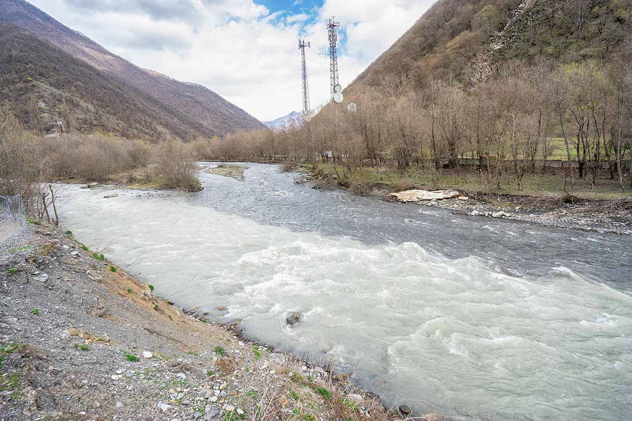
The birthplace of khinkali is considered to be Mtiuleti – a mountainous area of Eastern Georgia, occupying the territory of the Greater Caucasus Range and its foothills. The village of Pasanauri is only a small part of it. Due to its location right on the Georgian Military Road, it has become the most popular of all Mtiuleti settlements, and bears the title of the place where khinkali was invented. Well, this famous dish is really worth trying here in one of the local cafes.
Gudauri
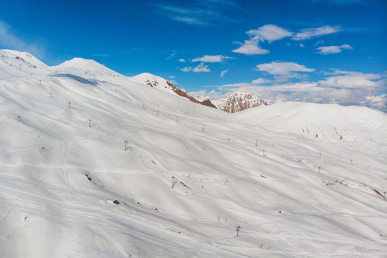
This famous ski resort is located at 2150 m above sea level, on the slope of the Greater Caucasus Mountain Range. Gudauri is very stretched out in length, and if you are not keen on skiing, you will be bored here. From December to March it is very lively and crowded. Of course, in winter it is more interesting here than before the season, but from the second half of July until the beginning of May the lifts are functioning, and there are many different ones. In principle, you can go for a ride, admire the breathtaking views, see the mountain peak Sardzeli (3300 m). Keep in mind that after the end of the ski season, the lifts work until 15:00-16:00.
Arch of Friendship of Peoples
The Friendship Arch is located practically on the Cross Pass, right at the GMR, 126 km from Tbilisi, at an altitude of 2385 meters above sea level.
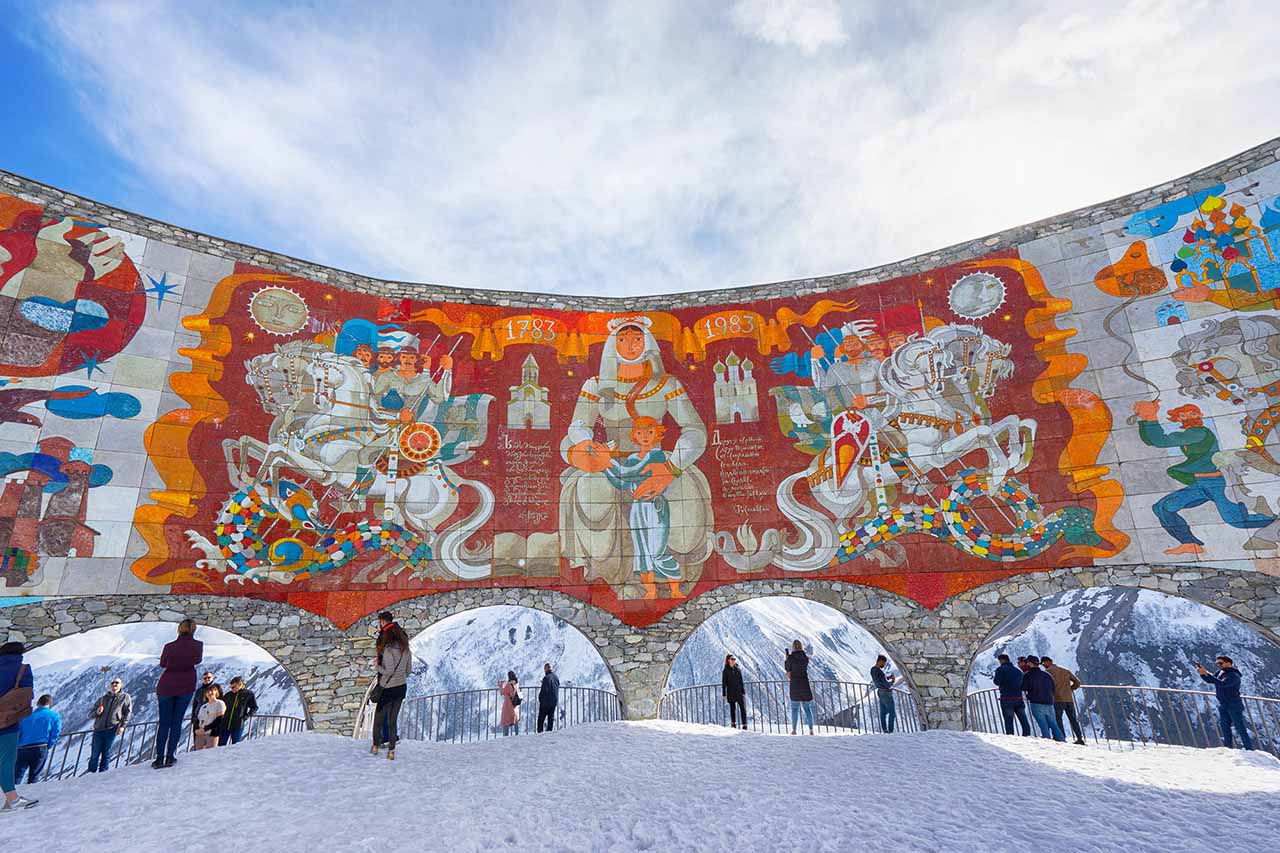
This is a fairly large structure, which is an observation deck with a mosaic wall with arches, standing in a semicircle. It is built right above the Aragvi Gorge. The Arch of Friendship of Peoples is dedicated to the 200th anniversary of the signing of the Treaty of Georgievsk. The author of this monument is Zurab Tsereteli.
The walls of the arches of the observation deck are decorated with a mosaic panel with scenes from the history of Georgia, as well as quatrains from Shota Rustaveli’s poem “The Knight in the Panther’s Skin” and dates: 1783-1983 – the years of signing the Treaty of Georgievsk and the construction of the monument. The platform offers a breathtaking view of the Aragvi River gorge and the Greater Caucasus Mountains, and you can also see an artificial lake of regular shape with turquoise water.
Near the Arch of Friendship of Peoples, they also sell all kinds of fruits, souvenirs, there is a summer cafe, but nothing special. The prices are quite high. In general, there are always crowds of people here, a long line for the toilet, so it’s better not to linger there for lunch, but just admire the views and move on.
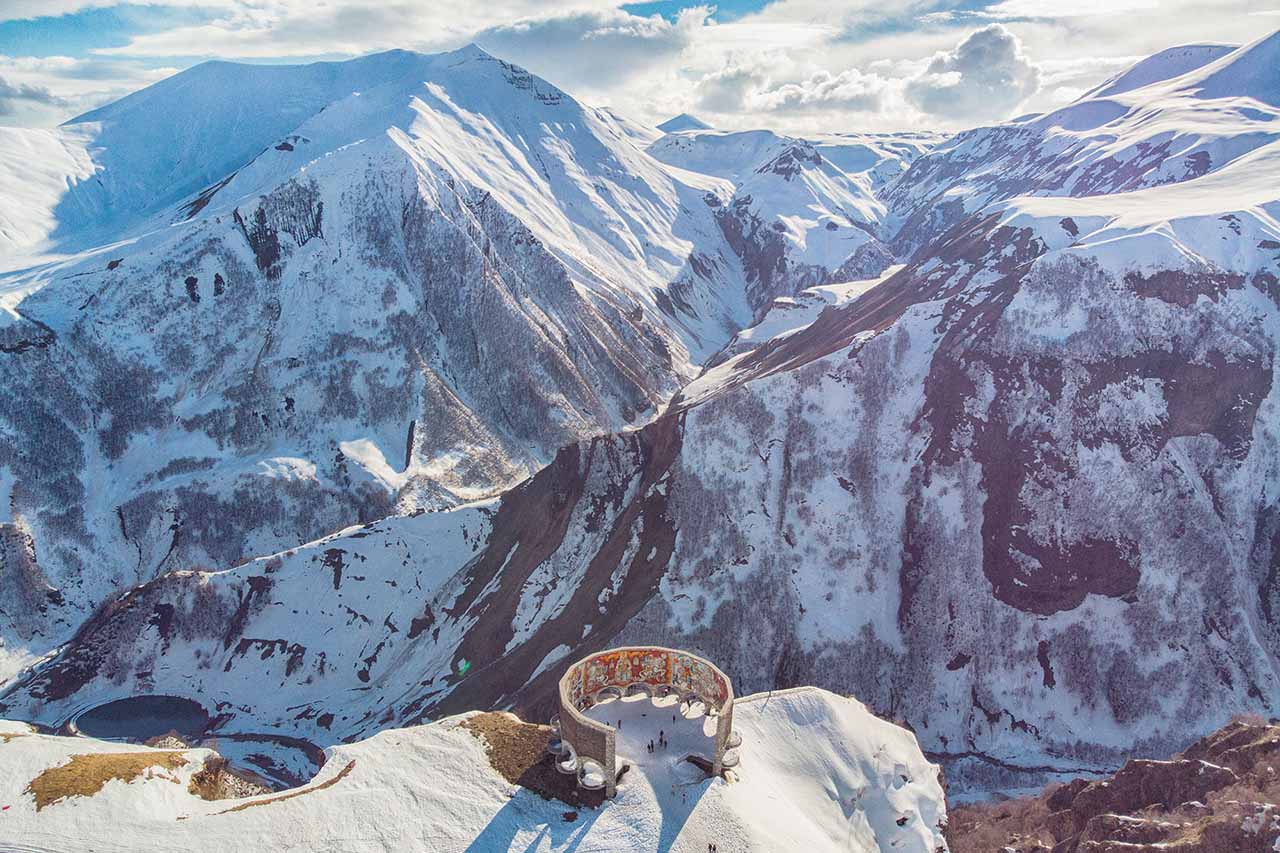
The last time I was there was mid-April and there was still a lot of snow, and a few days later there was so much snow that the road was closed for several days.
Cross Pass
The Cross Pass is the highest point of the GMD, its height is 2395 m above sea level. It is called the Cross Pass in honor of the cross erected by General Yermolov to mark the highest point of the road in the first half of the 19th century. At the pass, back in 1769, the Georgian Tsar Irakli II personally met a small Russian army led by General Totleben. There is an observation deck on the pass called the “Arch of Friendship”, implying the friendship of the peoples of Russia and Georgia. It was installed in honor of the 200th anniversary of the signing of the “Treaty of Georgievsk”, in 1983. The observation deck offers magnificent views of the gorge of the white Aragvi.
Waterfall in Arsha
This place is one of the least known on the Georgian Military Road. To get to the waterfall, you need to walk for more than an hour from the highway. I drove along a dirt road in an SUV, but there was still quite a distance to the waterfall, so I filmed it with a drone.
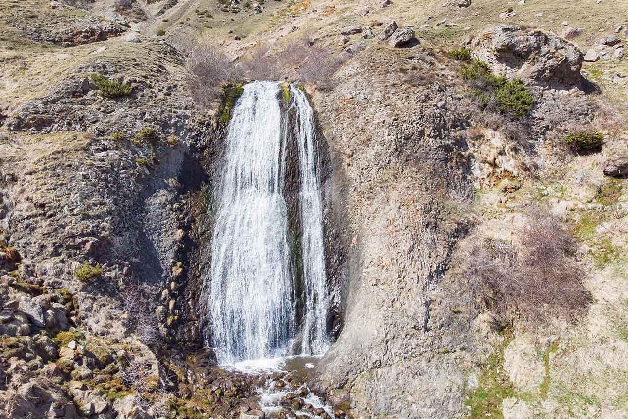
In fact, there are three waterfalls here. They are located above the village of Arsha, by a river called Chkhatiskali. Translated from Georgian, they are called “Men’s Tears,” “Beard,” and “Maiden’s Braid.” Only the Beard is visible from the road.
As usual, such names are accompanied by a local legend about tragic love. It tells the story of a boy and a girl who loved each other. But the girl’s parents accepted a matchmaking proposal from an important and rich man.
And the girl, out of grief, committed suicide by throwing herself off a cliff. Her beloved ran after her, but was only able to touch her beautiful hair seconds before she jumped, and was unable to save her.
It is in this place, according to legend, that the waterfall “Maiden’s Braid” (about 30 meters high) appeared, and above it – another one, in which the water flows down in drops, and this is reflected in the name – “Men’s Tears”. The lover of the deceased girl cried bitterly, and tears rolled down the cliff. He remained faithful to his love until old age, and it is the Beard waterfall that represents this fidelity until old age.
Its height is 20 meters. Each of the three waterfalls is beautiful in its own way: Beard is lower and clearly visible from the road, above it is Maiden’s Braid, and at the very top are Men’s Tears.
Village Sno
Among Georgians, this place is known, in particular, for being the birthplace of Ilia II, the Patriarch of Georgia. Guests of the country, in turn, go to the Juta and Sno valleys for breathtaking views of green mountains and inaccessible cliffs, for the harmony and silence of nature untouched by civilization.
There is an ancient watchtower here. You won’t be able to get inside it, but you can move closer behind the fortress wall — from there, a gorgeous view of Mount Kazbek opens up, you can take excellent photos with the tower in the foreground and Kazbek in the background. In my opinion, the view of Kazbek in Sno is even more wonderful than in Stepantsminda — both peaks are visible.
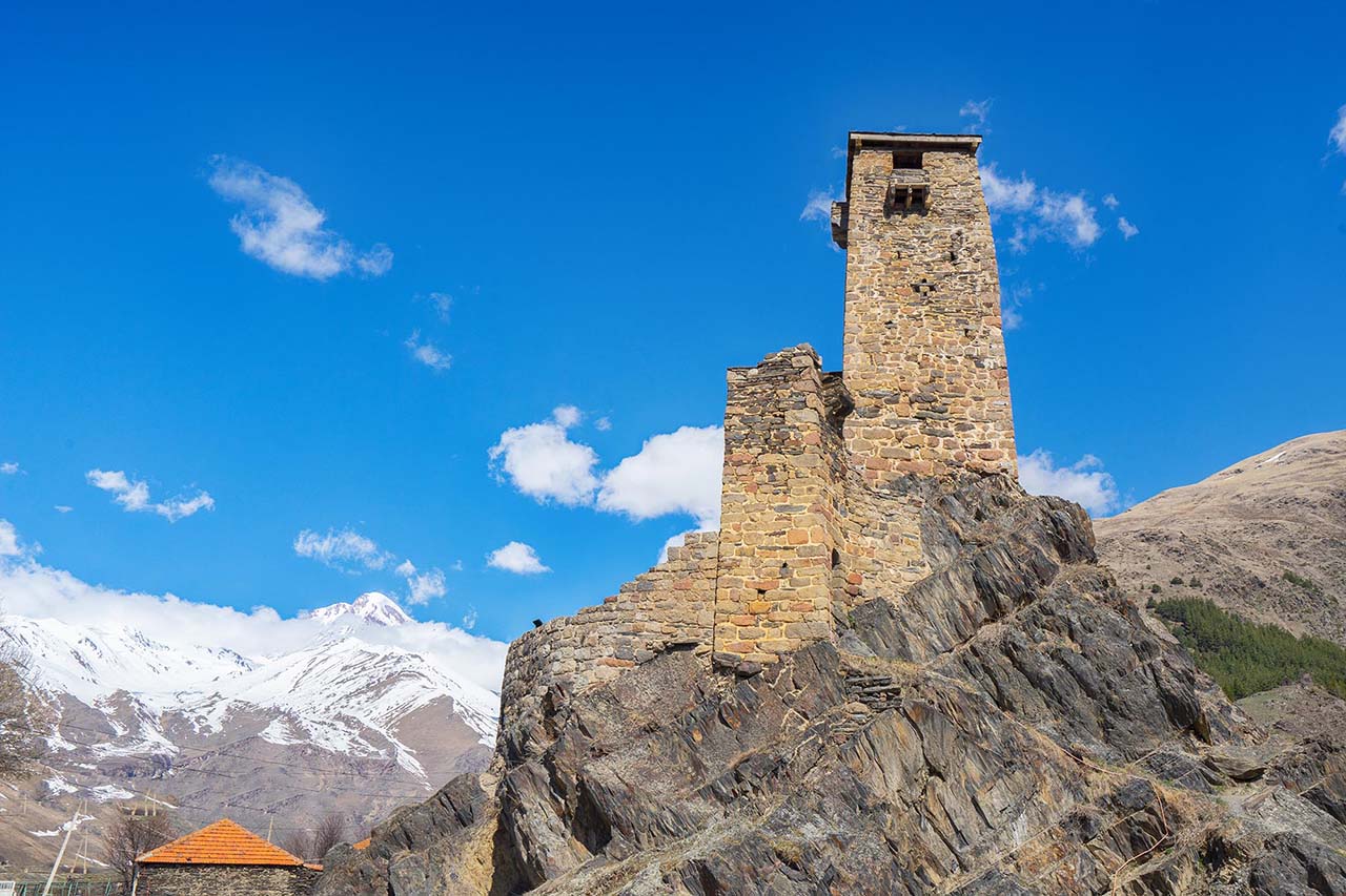
Oh, and another interesting fact about Sno: the film “Going Vertical” was filmed here – about the legendary victory of the USSR basketball team over the US team, which held the champion title for 36 years.
There are a couple of monuments in the village that you can see. There is also something else that is worth mentioning. When entering Sno, on the right, you will see huge boulders with carved human faces. Their author is a local sculptor, Merab Piranishvili.
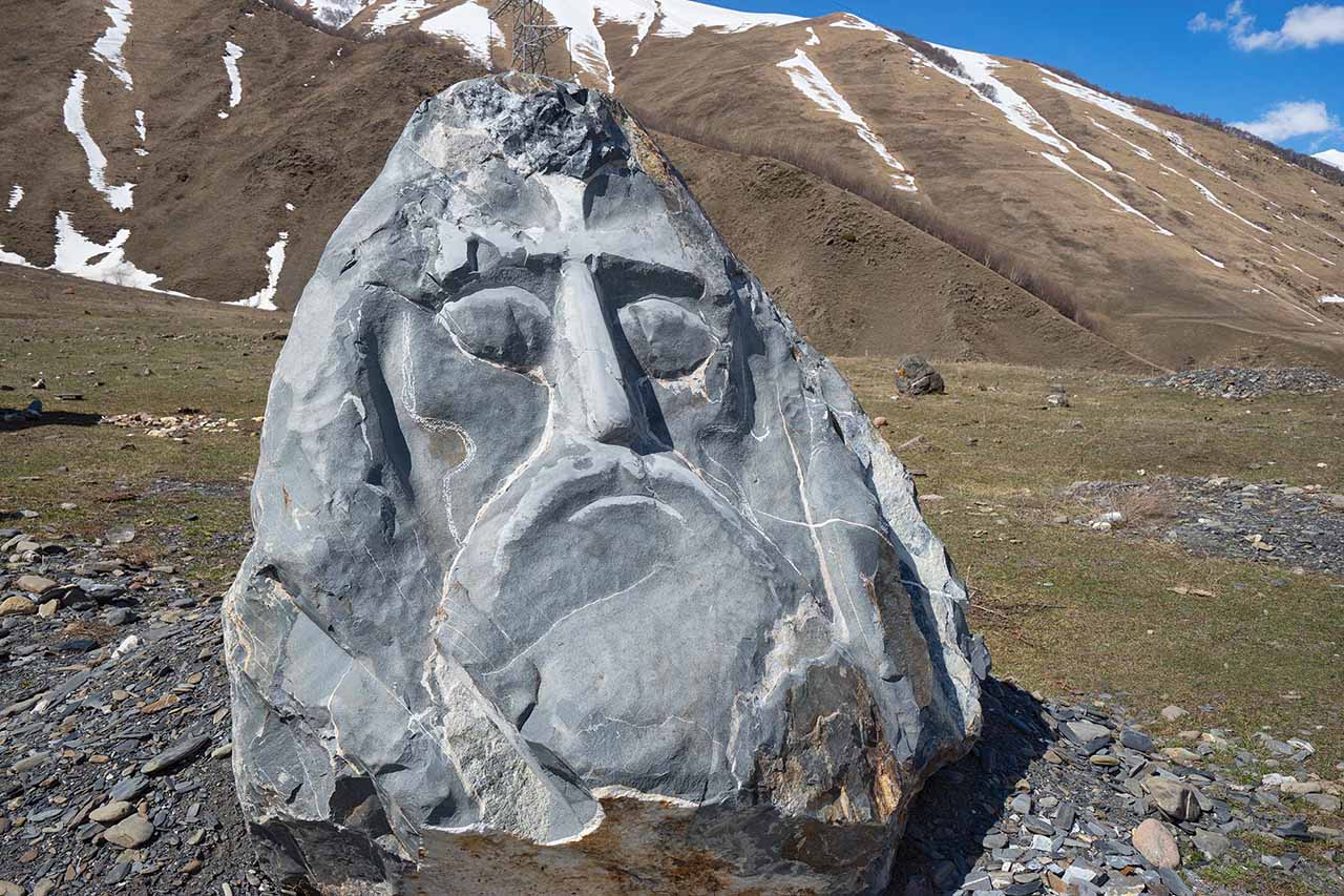
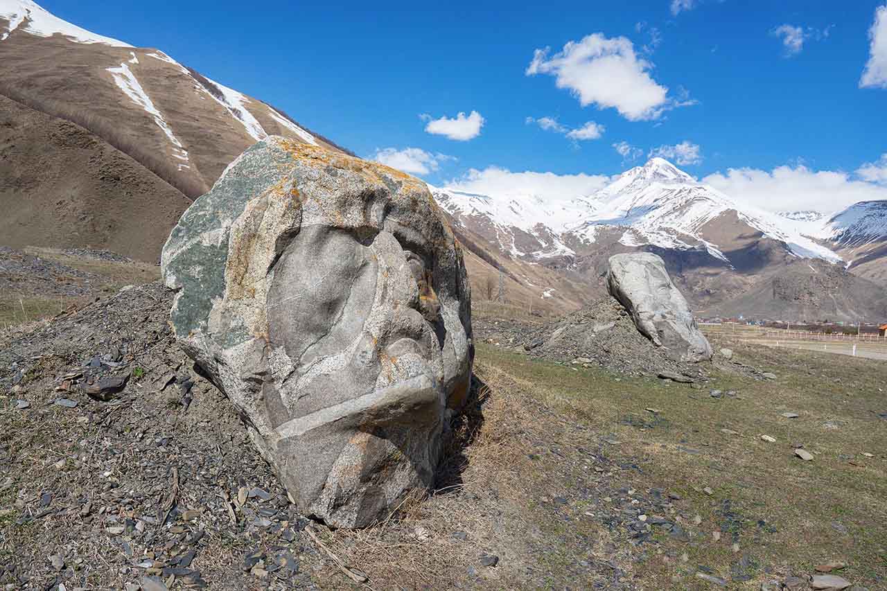
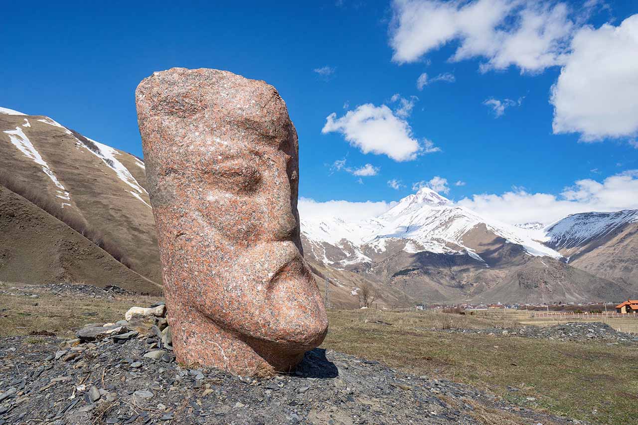
He works with an interesting device – something like a burner with a very high temperature. The burner runs on gasoline, consumes 13 liters per hour. It takes about 50 hours to make 1 sculpture. Such are the miracles in this place, seemingly forgotten by God and people.
Kazbegi and Gergeti (Trinity Church)
Kazbegi is the name of the village of Stepantsminda during the Soviet Union. In colloquial speech, as well as on minibuses, the former name, Kazbegi, is often used.
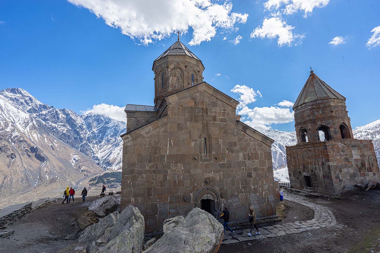
Gergeti is a village located on the opposite bank of the Terek River from Stepantsminda, at the foot of Mount Kazbek. The Holy Trinity Church, or Gergetis Sameba, rises above the village. It is the only cross-domed church in the area. All other churches in the area are built as basilicas. This is a 14th-century structure. In 1795, it was used to hide relics of the Georgian Orthodox Church: the cross of St. Nino and part of the relics of St. Thomas the Apostle.
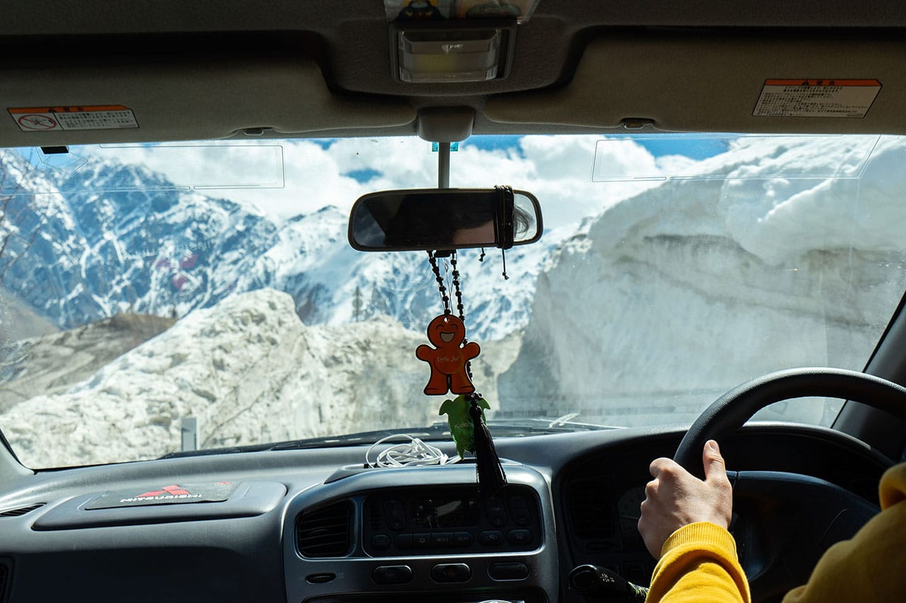
In 2019, a new road was built to the temple from Stepantsminda, but in winter it is closed to most vehicles due to snow and ice. Locals take tourists up on their own vehicles. I do not recommend going up to the church on your own transport from December to April. It can be dangerous.
Kazbek (5047 m) is often hidden by fog and clouds, and this has earned it the reputation of a “shy mountain”. Seeing it is a great success. Kazbek is an extinct volcano, the lowest of the 5000-meter Greater Caucasus Range. The greatest chance of seeing this beauty clearly is in the morning at dawn, or in the evening at sunset.
Stepantsminda has a good selection of cafes, restaurants and guesthouses, but don’t expect high-quality service or exceptionally tasty food. You can eat at the restaurant of the hotel Kazbegi Rooms Hotel — an excellent 4-star hotel.
Gvelet waterfalls
Beyond Stepantsminda (Daryal Gorge), practically on the border with Russia, in the Kazbek Gorge there is a beautiful waterfall on the Gveletistskali River, 25 meters high and 2 meters wide. To see it, you need an SUV, or you will have to walk part of the way (about 3 km), leaving the car in the half-empty village of Gveleti. Locals can also take you there from Stepantsminda.
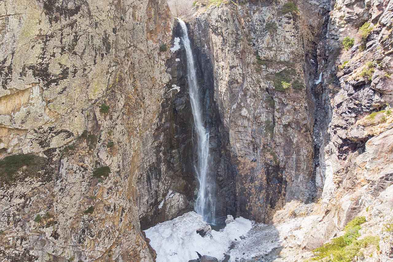
To get to the big waterfall, you need to turn right after this sign and cross the bridge. From here you will have to go along a narrow path running up.
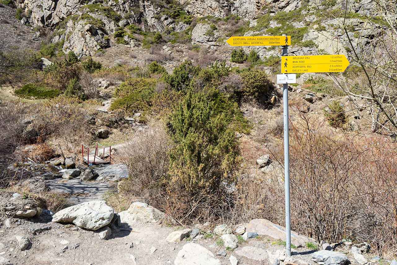
The path is narrow, picturesque, and goes uphill – be careful. But the waterfall is really very beautiful and worth your attention.
Georgian Military Road on the map + route
I made a map marking the places worth seeing along the way. It will come in handy if you go on your own.
Georgian Military Road FAQ
How long does it take to drive the Georgian Military Road to Kazbegi?
About 3 hours without stops. But the whole point of the trip is the stops, so with Ananuri, the Friendship Arch and Gergeti it takes a full day.
Is the Georgian Military Road open in winter?
Yes, but in heavy snowfall it is closed, sometimes for several days. There can be snow in April and October too, so in any off-season be sure to check the road conditions before you go.
Do I need a 4×4?
In summer, to Stepantsminda — no. In winter and for trips to Juta, Truso and the Gveleti waterfalls — yes.
Can you do the road in one day?
To Stepantsminda and back — yes. I wouldn’t go further on the same day: you’ll be very tired.
Tips for tourists:
Best hotels in the mountains of Georgia
Souvenirs – what to bring from Georgia as a gift
How to get from Tbilisi to Batumi – all options
My name is Vitaly Kibitlevsky, I am a tour guide and creator of unique quests in Batumi. If you want to walk around the city with a fascinating storyteller or plunge into an exciting adventure, write to the mail: vitkibit@gmail.com
Find out more about me and my projects here