History of Khevsureti
In the north of Eastern Georgia, high in the gorges of the Caucasus Mountains, there is one of the most beautiful and pristine regions – Khevsureti. This region seems to “straddle” the Greater Caucasus Range, located both on its northern and southern slopes. Due to its geographical location, Khevsureti is divided into Inner (southern slopes – Piraketi) and Outer (northern slopes – Pirikiti). These two regions are connected by the Arkhotsky and Bear Passes.
Khevi – translated from Georgian, means “ravine”, “gorge”. From this word comes the name of the region, which has many gorges and mountains.
Unfortunately, now, the land of brave Khevsurs, “thanks” to the policy of the Soviet Union, is practically deserted. Residents were forcibly resettled to the valleys. In the entire region, only a couple of hundred families remained, the rest of the highlanders went down to the cities and villages of the plains of Georgia. Maybe that is why nature has preserved its virgin appearance, and this greatly attracts tourists, especially from Europe.
At the moment, Khevsureti is the least populated and practically undeveloped region. This should be taken into account by tourists who walk, already in quite large numbers, along the slopes of this region.
Khevsurs
The first mentions of a harsh region with formidable and fearless mountaineers date back to the 15th century, but this does not mean that Khevsureti was inhabited in the late Middle Ages. The inaccessible gorges were inhabited earlier, and pre-Christian traditions and customs still played an important role in the life of this people.
Only in the “Golden Age”, during the reign of King George III and his daughter Queen Tamara, did the Georgian rulers think about protecting their borders from their northern neighbors. So they began to use the Khevsurs as border guards. And the reward for fulfilling such a duty was exemption from paying any taxes to the treasury.
Proud, subject to a special code of honor, formidable and fearless Khevsurs, who were famous for their militancy and bravery, fought with their neighbors at all times. If it was at least somehow possible to understand their hostility towards the northern Muslim neighboring peoples, the Ingush and Chechens (although ethnically, these peoples are close), then the aggression against their co-religionists, the Pshavs and Tushins, was completely incomprehensible.
And what about the Pshavs and Tushins? The Khevsurs repeatedly went to war against each other, the Pirakets against the Pirikets. And the Caucasian vendetta (blood feud) was also cultivated among the people, which did not allow the conflict to subside, even if it flared up over a trifle.
Origin of the Khevsurs
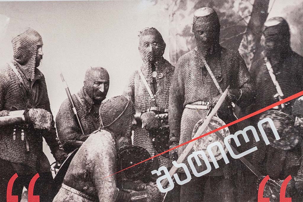
Having become acquainted with the national costume of the Khevsurs and their way of life, the Russian ethnographer Arnold Zisserman put forward the hypothesis that the Khevsurs are heavily Georgianized descendants of European crusaders. This hypothesis has more serious grounds than it seems.
There are many surviving documents testifying to contacts between Georgians and crusaders; the Khevsurs wore chain mail up until the 20th century, which is not typical of the Caucasian peoples. The Khevsur straight sword also resembles the European one. The highlanders themselves always obeyed only the Georgian king, did not recognize any feudal lords, and lived in tribal communities. The Khevsur warriors represented the “elite” detachments of the Georgian kings. Moreover, anthropologically, the Khevsurs differ from the Georgians and are close to the Europeans.
When the royal power in Georgia weakened, the Argveti princes wanted to annex this region to their principality. However, this accession was purely formal.
In the 19th century, the region suffered terrible trials.
Firstly, the campaign of Simanovich in 1813. The army of General Simanovich captured Khevsureti with heavy fighting, fire and sword.
Secondly, in 1843, the troops of Imam Shamil went to war against the Khevsurs, who demanded that the highlanders recognize his authority and renounce Russian rule. But the Shatilians refused, having lost 2 people in the battle, they killed more than a hundred of the imam’s soldiers.
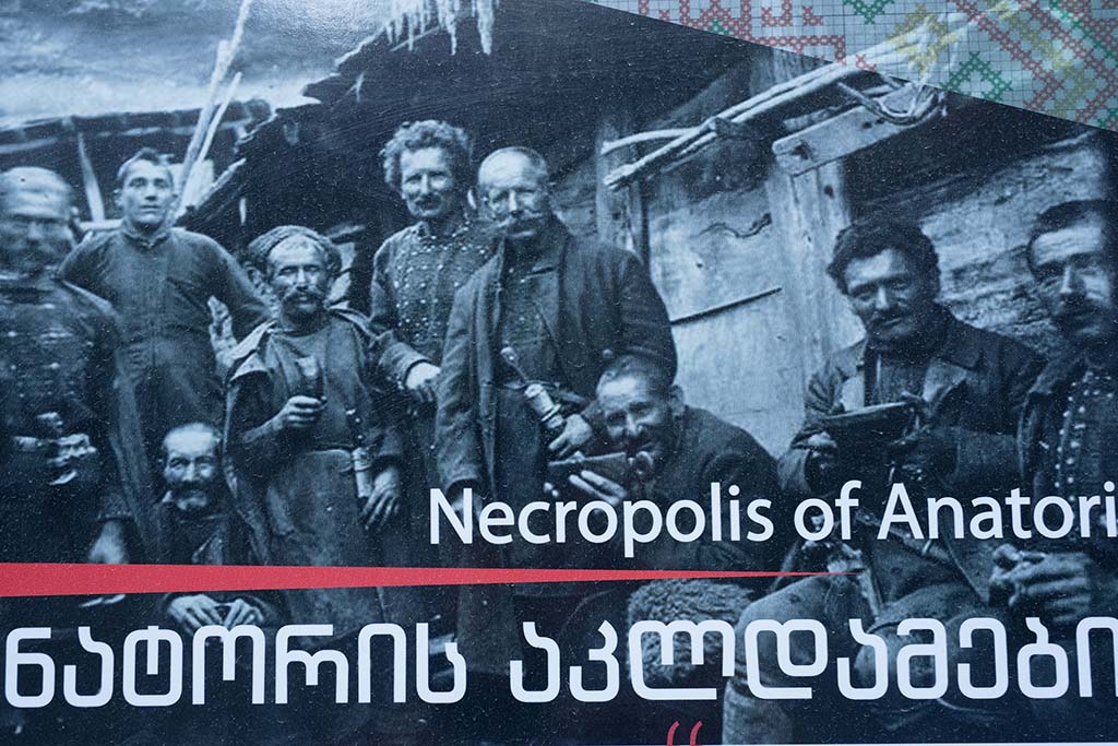
Thirdly, the plague of 1850, which mowed down almost the entire population. The entire village of Anatori, except for one person, “moved” to the burial grounds, which are now one of the tourist attractions of Khevsureti.
The Soviet government played a significant role in the devastation of the mountainous region and its depopulation. Later, some of the highlanders returned, but they settled not in fortresses, but in ordinary houses, where there are more amenities. This is how the village of New Shatili appeared.
In 1942, when the Ingush and Chechen people were repatriated, the Khevsurs were forcibly resettled to their deserted villages. Some highlanders fled to avoid repatriation, they hid in the mountains, then the code of honor was revealed, the Khevsurs, living in the houses of the Ingush and Chechens, fed the fugitives secretly from the state authorities.
In the 50s of the 20th century, when the repatriates were returned to their lands, the Georgians voluntarily left their homes and returned back to Khevsureti.
Khevsurs in the photo
Unfortunately, not many old photos have survived. And if ordinary national clothes can still be seen in almost every house or hotel in Khevsureti, then combat outfits have become a great rarity. Several photos can be seen on information boards near Shatili, Anatorium burial grounds and Mutso. The shots below are taken from there.
Ethnography and life of Khevsuretia
As mentioned above, the highlanders lived in tribal communities. At the same time, the people were divided into two castes:
Warriors, who were engaged in raids and robbery, as well as the protection of their property;
Shepherds and farmers, who bred cattle and grew a meager harvest due to climatic conditions.
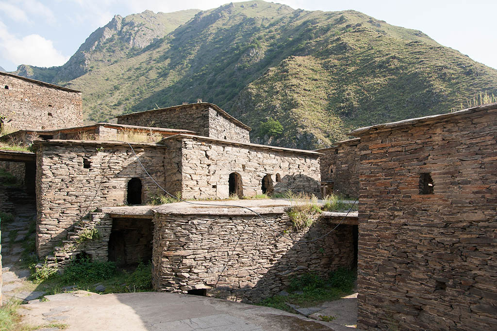
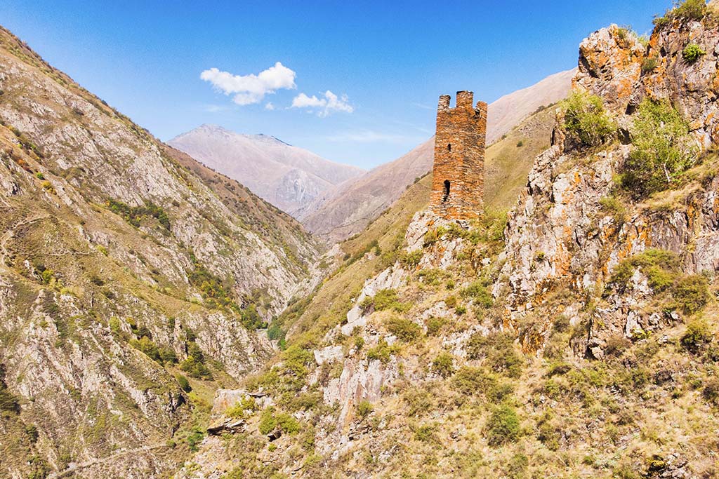
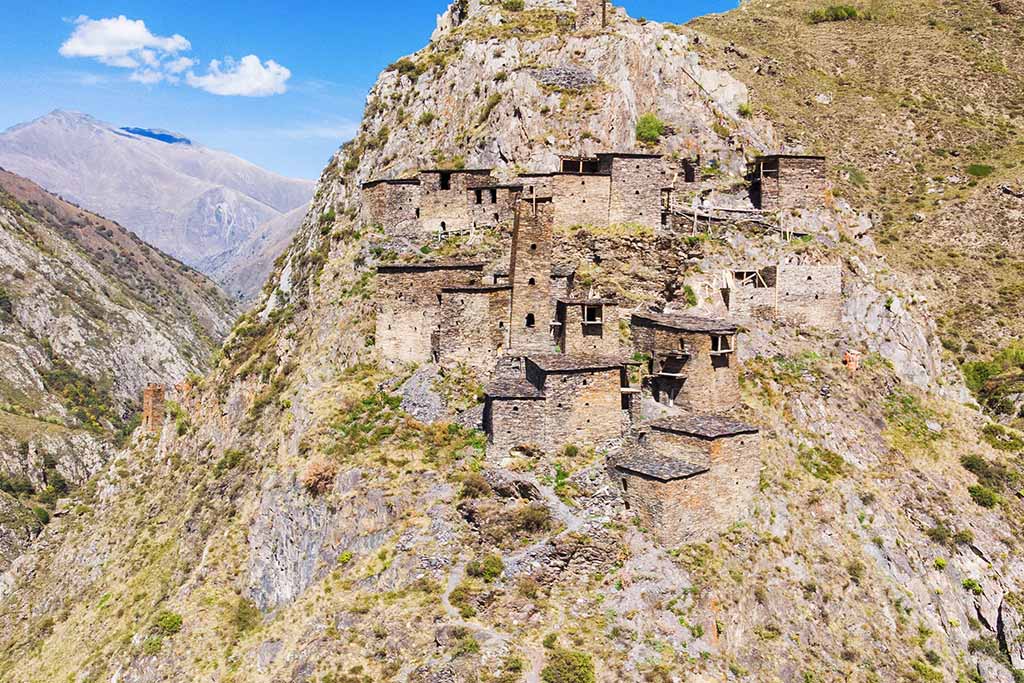
Since the Khevsurs were trapped in snow for half a year, their entire life and infrastructure came from this. Their village was one large fortress, where towers and turrets were attached to each other and connected by both obvious and secret passages.
The fortresses became impregnable, their walls seemed to be an extension of the rocks. Therefore, the Khevsurs practically did not know defeats from external enemies. The highland village-fortresses are brilliant, unique monuments of Georgian construction architecture. Each clan settled in its own gorge, used it and protected it from the raids of neighbors.
Although everyone lived in the fortress, each family had its own small tower.
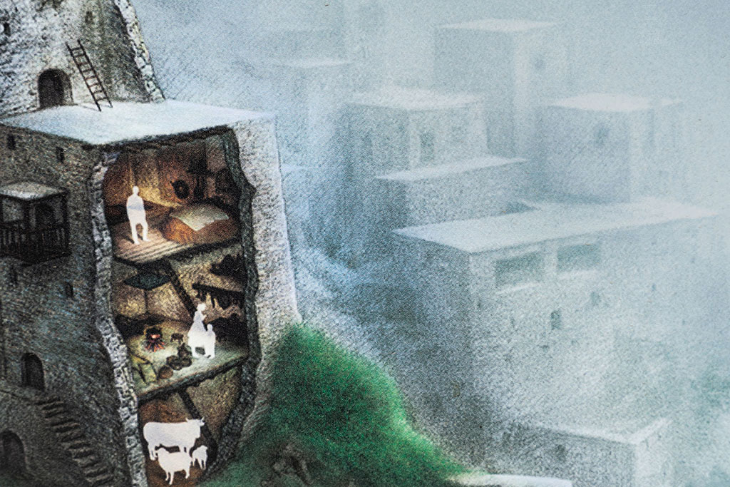
Communication with relatives was maintained through both external and internal passages. During long winter evenings, women sewed, knitted and embroidered amazingly beautiful folk costumes. A cross was embroidered or knitted onto almost every element of the national costume. Men kept their weapons ready and guarded their fortress.
What to see in Khevsureti
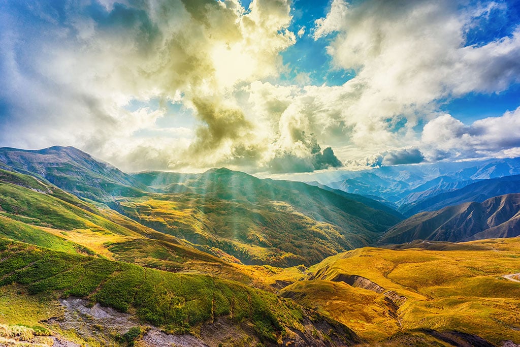
Khevsureti is an ideal region for ethnographic travel and trekking (hiking), which is what tourists take advantage of. The region has several significant historical and cultural monuments, as well as fabulous natural landscapes, against which photographs become masterpieces. And unlike the well-known Upper Svaneti, there are no large masses of tourists here yet. Which is an undoubted plus.
Unfortunately, the tourist infrastructure is still at an initial level, but there is hope that everything is still ahead. Since normal roads have not yet been built to the region, it is recommended to go to Khevsureti by SUV. For trekking enthusiasts, colorful routes have been developed.
The classic popular one is Shatili-Mutso;
The new, gaining “momentum” Barisakho-Roshka-Chaukhi pass-climbers’ camp Juta;
Juta-Roshka.
While walking these routes there is a high chance of meeting other travelers, especially on weekends, as these routes attract local youth.
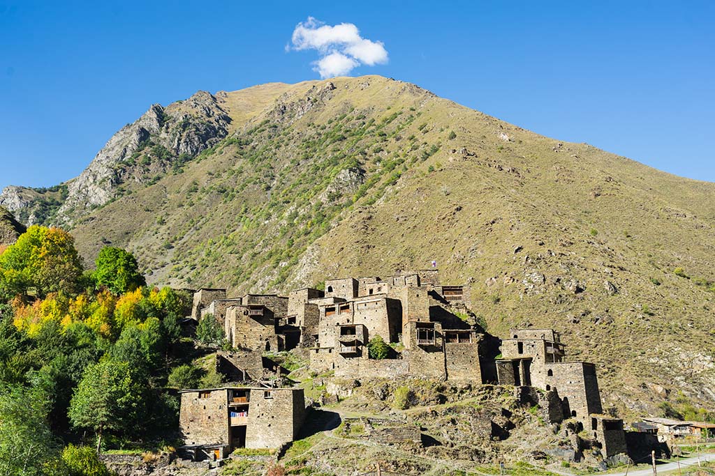
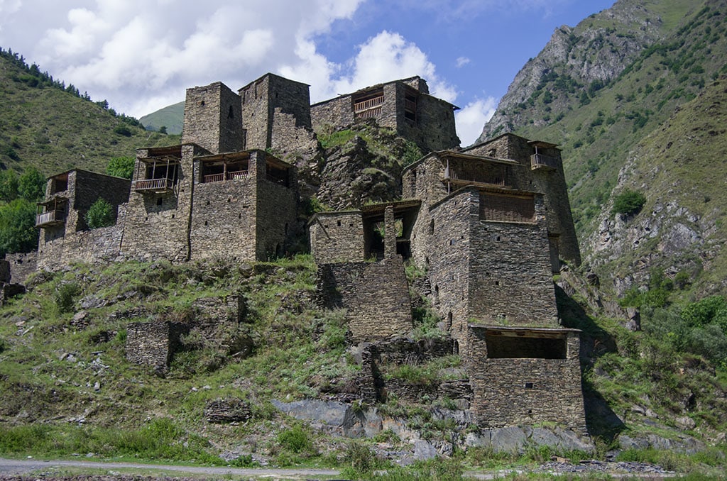
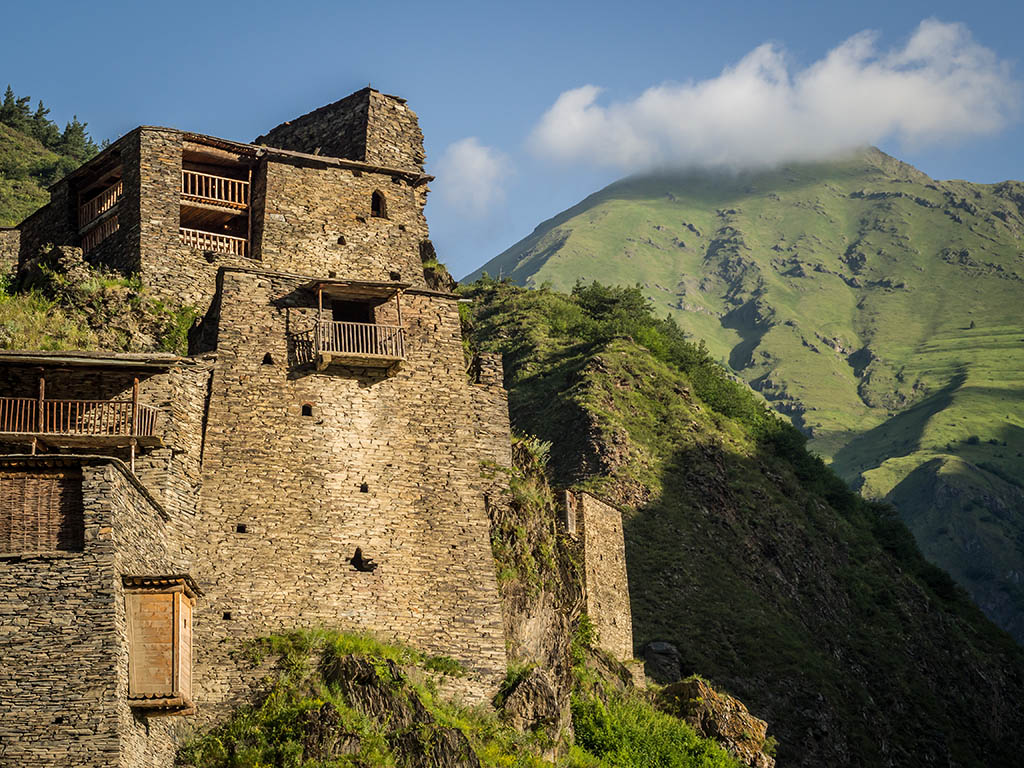
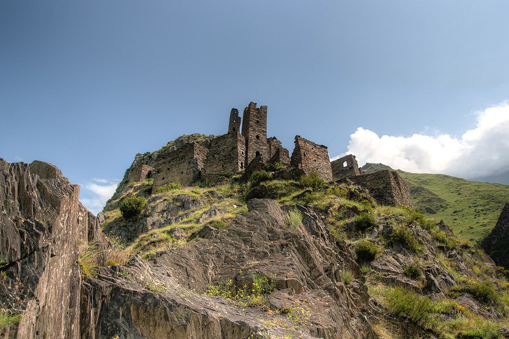
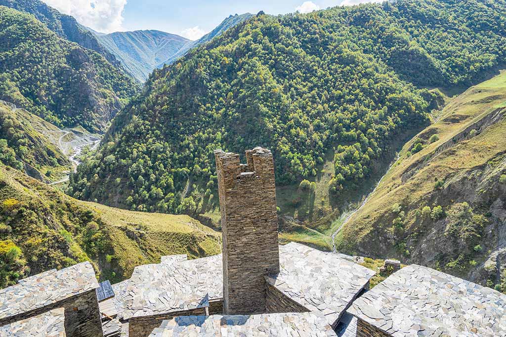
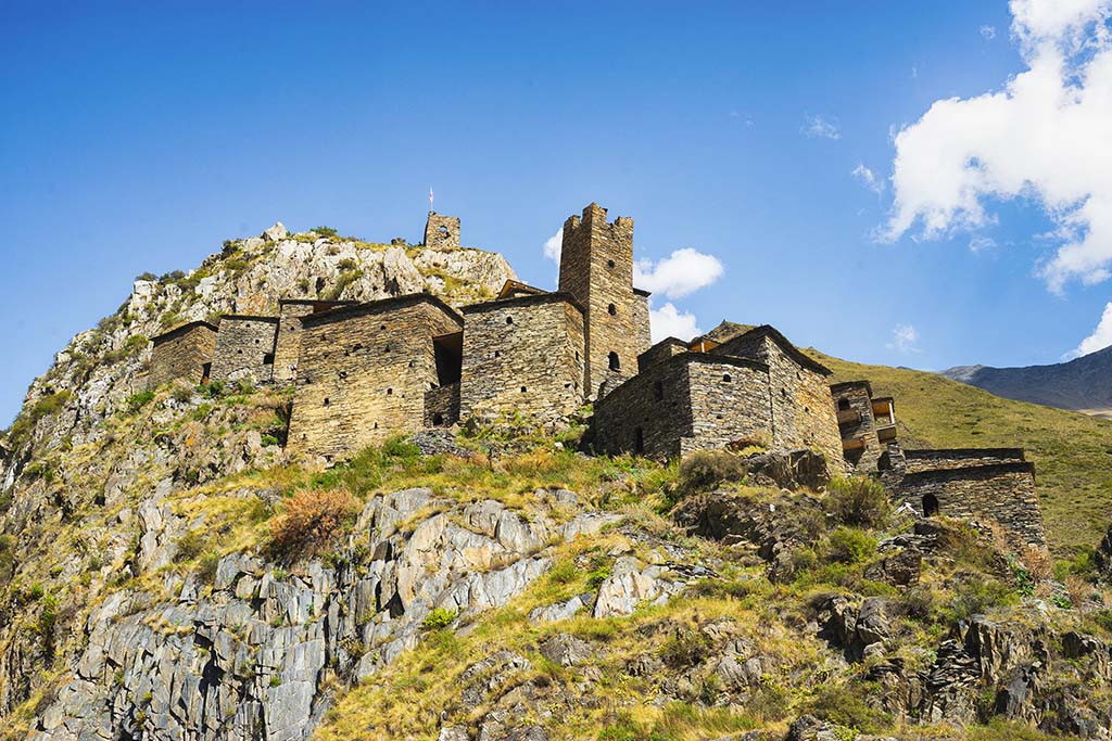
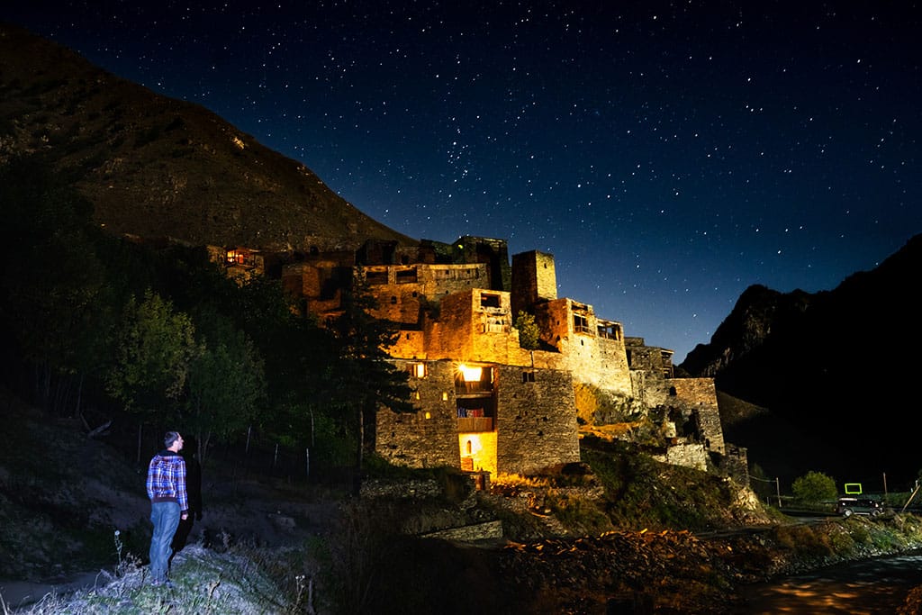
Shatili
Shatili is the most famous medieval fortress city in the region. A strategically important place was chosen for its construction. Situated on the right bank of the Argun, the fortress not only guards the gorge, but also controls the paths leading from Chechnya, Ingushetia, Dagestan and Tusheti.
Now, a new village has been built near the fortress, which is the main settlement of the region.
Tourists are interested in the old unique fortress, which is a tower complex that served as a residential area and a defensive fortification structure. At the moment, the fortress has been almost completely reconstructed and it is very interesting to wander around it.
With the exception of a few towers, old Shatili is empty. Therefore, you can easily get inside many buildings. You can climb to the roof to admire the beautiful view and take memorable photos. Some towers have completely new wooden floors and stairs. And in some, ancient wooden floors and household items are still partially preserved.
Shatili is located on the northern slope of the region. Tourists can walk around the ruins of the fortress freely, there is no need to buy tickets to see it.
Shatili suffered its first serious defeat from the army of Simanovich, who burned it down along with the neighboring fortresses in 1813.
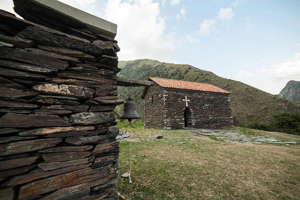
Between the fortress and the new settlement there is a clearing for ritual services (sanctuary), which is called Jvari. From time immemorial, women were forbidden to enter the territory of Jvari. However, due to numerous questions arising, the Khevsurs completely fenced off the sanctuary from tourists. Although almost any man can enter there, it is better to ask permission. Above the sanctuary there is a small grove, which is an excellent place for a rest.
Shatili often became the “muse” of poets and artists. This fortress was praised in heroic ballads, described in literary works, and depicted on canvas by outstanding artists.
Anatorium burial grounds
The Anatorium burial grounds are monuments to the terrible plague, or perhaps smallpox, which “mowed down” the Khevsurs in the middle of the 19th century. There are still a lot of human bones in the burial grounds. They say that the sick themselves, on their own feet, walked there, where they waited on benches for their turn. The burial ground is a small one-story building. It is impossible to get inside. Because there is no entrance. A strong grate is inserted into the small windows. Behind which the plague patients found their last refuge. Impressionable people should avoid visiting this place.

Warning! The burial grounds are located on the edge of a high cliff. Be very careful and attentive when exploring them.
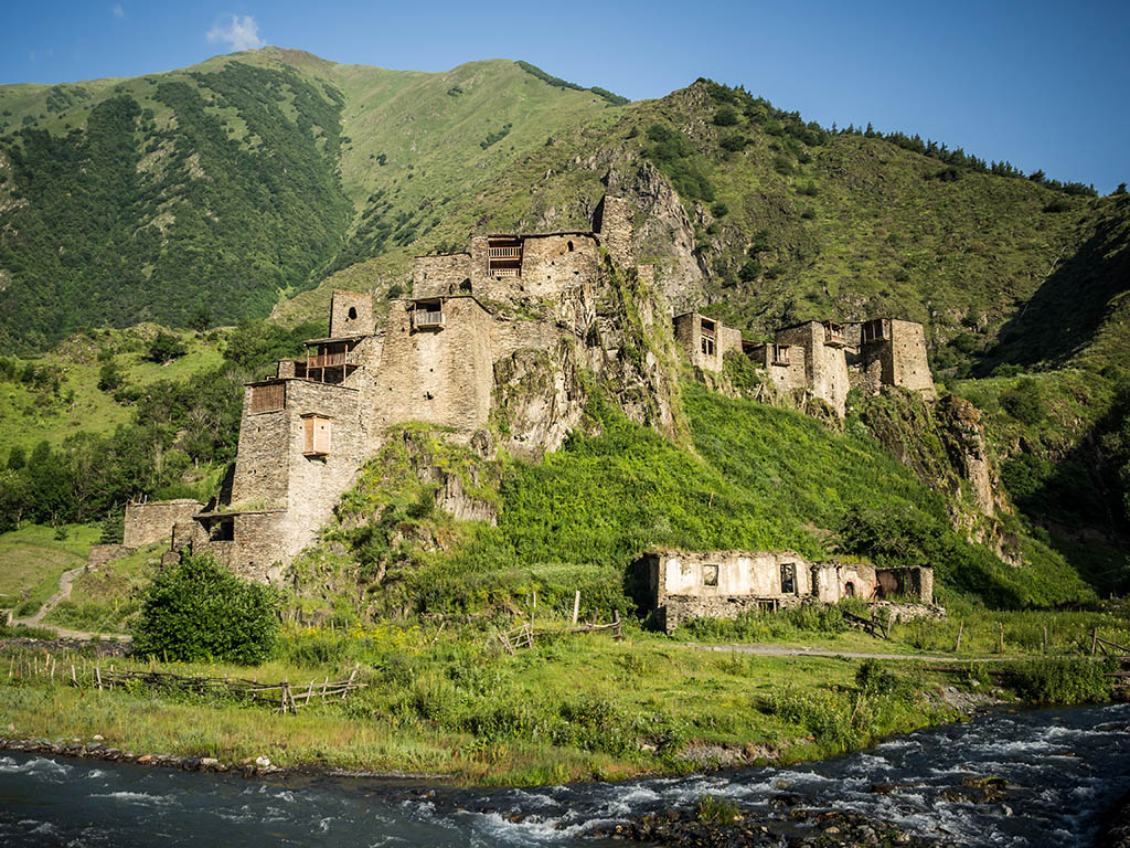
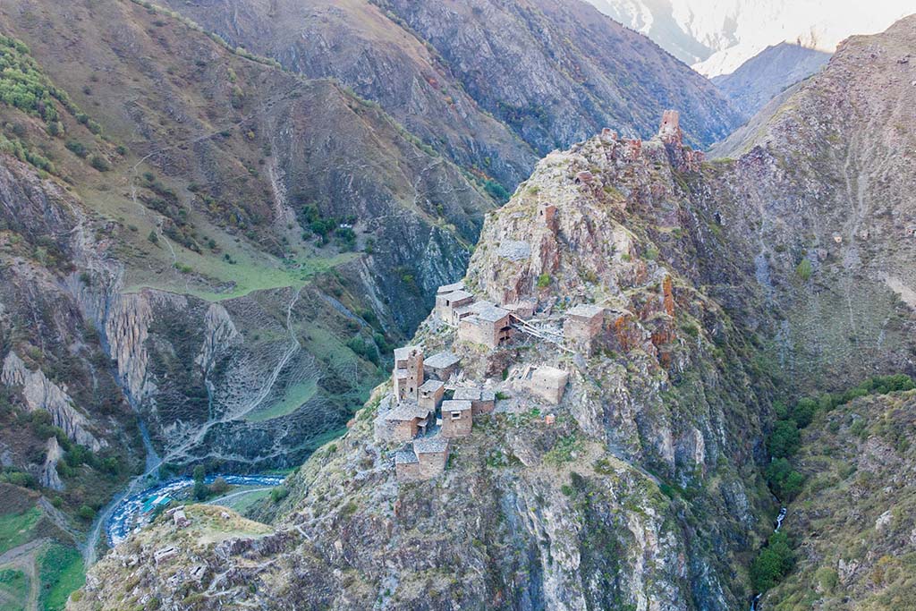
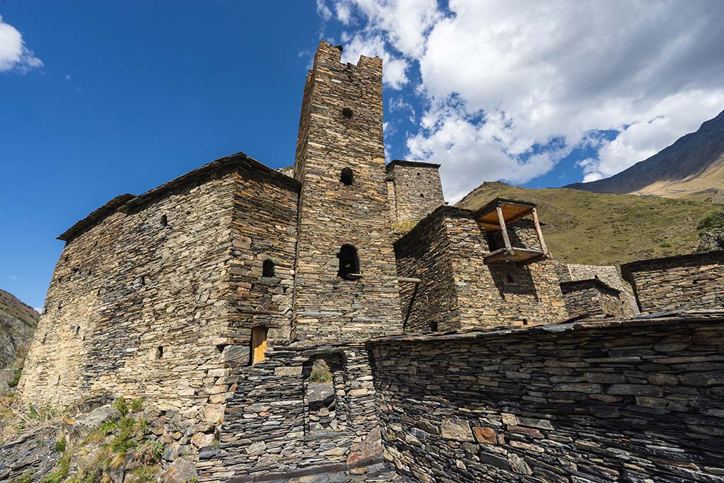
Mutso
Mutso is a fortress that protects the northern borders of the country. The fortress is located north of Shatili, they are separated by a 12-kilometer trail that has become a popular trekking route. You can drive along it in an SUV. But despite the short distance, the road takes about an hour.
According to legend, Mutso was built by the Great Queen Tamara, specifically to protect the northern borders.
Another legend says that the great Khevsur warrior Torgvai decided to build a fortress. All the Khevsurs came to his aid, they stood in a row from the village of Anatori and began to pass stones to each other, and so they built the Mutso fortress in one day.
No one knows when the fortress became empty: either after the destructive campaign of Simanovich, or earlier, but by the middle of the 19th century it was already empty. With the development of the tourism business, the ruins of Mutso were restored. According to the plan, the restoration of the fortress should be completed in 2018. In October, a couple of weeks before the pass closed, they were still going on. Although most of it was finished.
5 kilometers from Mutso there is a “village” of Adroti, or rather, there was one. Now only one family lives there. It is the last village in the region.
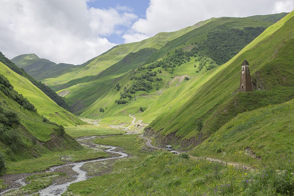
Bear Cross Pass
The Bear Cross Pass (2677 m above sea level) is located on one of the peaks of the Caucasus Range and divides Khevsureti into two parts.
The road along the pass is the longest and slowest part of the journey, but the views that open up from it will be remembered for a lifetime. Be sure to make a stop at the highest point of the pass. No photo will convey the beauty and volume of the space spread out before you. At the peak, it is usually cool and a piercing wind blows.
Abudelaur Lakes
Abudelauri Lakes are a landmark of Southern Khevsureti, located near the village of Roshka. These are three small lakes, named after the color of their water: White, Blue and Green. They are scattered at an altitude of 2600 to 2800 meters above sea level. Streams flow from these lakes, forming the Abudelauri River, which flows along the valley of the same name. A trip along the lakes can take a whole day.
The first one that travelers come across after leaving Roshka is the Green Lake, it is small and uninteresting. It is called so because the grass of the surrounding meadow is reflected in the water. You can pitch a tent near the lake if you decide to climb the Chaukhi Pass.
The next lake on the way is Blue Lake. It is especially picturesque during the high water period, at the same time, there is a riot of rhododendrons in bloom. The Blue Lake is not surrounded by meadows, but by rocks left over from an ancient volcanic eruption. Many tourists prefer to stop and camp at this lake. There are many visitors to this lake, especially on weekends.
White Lake is located 200 meters above Blue Lake. But to the traveler it seems that it is in a completely different climate and geographic zone. There are no rhododendrons near White Lake, almost no grass. There is almost nothing alive around the water, the color of heavily diluted milk, only lifeless scatterings of stones. The lake is located at an altitude of 2815 meters, which makes it the highest mountain lake that a simple traveler can reach. Only Lake Kelitsad is located higher, but only climbers with professional equipment can reach it.
The two lower lakes are on the trekking route to Dzhuta. White Lake remains a little to the side.
Information for tourists
Since the region is poorly developed and has not yet been improved, there is practically no Internet here. Mobile Internet in Shatili works, but very poorly. Magti or Geocell work best. There is practically no connection or Internet beyond Shatili.
The season in Khevsureti is from late May to mid-October. Later, bad weather and snow make it impossible to get there by car. The pass is closed. Once a week, a helicopter flies for border guards and the few residents who stay for the winter.
As for safety, the Khevsurs, despite their reputation as a militant people, are very hospitable. A guest for a Khevsur has always been considered an inviolable person, so from the people of Khevsureti you can see only smiles and hospitality, a willingness to help and advise.
Nevertheless, in this region there is a certain degree of danger, which can come from wild predators, if any are encountered, and … dogs. Dogs in Khevsureti herd flocks, and shepherds are not always with them, so no matter how great the temptation, it is better not to approach the sheep. If there is a shepherd with the flock, he will approach you himself. In principle, dogs do not show aggression, but “better safe than sorry”.
Where to stay in Khevsureti
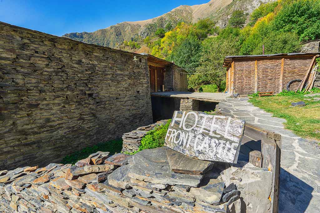
The most popular and convenient for an overnight stay is Shatili.
Please note that there are only simple rural guesthouses here. As far as I understood from talking to locals, there is not a single hotel with individual bathrooms. They are shared throughout the entire house or one per floor. Keep this in mind and check in advance. Since some hotels indicate that they have individual ones, but in fact they are shared.
There used to be about a dozen offers on Booking. But after Covid, many closed. In any case, the hotels where I stayed are not working. Considering that hotels in the area are open only in the summer, I advise you to select them either through Google maps or Booking, but a few days before the trip. Because if you go to Booking in winter, the site will show 0 hotels in the region.
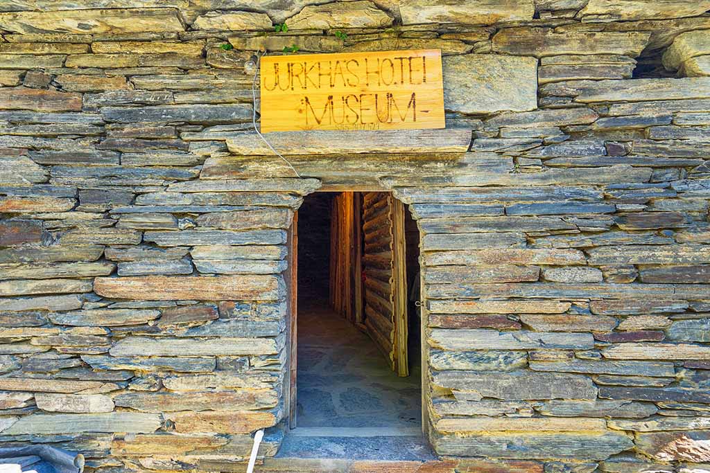
Jurkha’s Shatili Tower – the rooms here are in a real ancient tower!
There are practically no shops or cafes in the region, so it is better to take food and water with you on your trip.
How to get to Shatili (Khevsureti)
Khevsureti on the map of Georgia
If you look at the map of Georgia, Khevsureti is at the top, on the border with Russia. It is easy to find if you draw a line vertically upwards from Tbilisi.
On maps, it is best to navigate by Shatili. Since this is the main and most important region. To see its location relative to Tbilisi or the whole country, just reduce the map in scale.
Tbilisi – Shatili Road
It should be noted that it is advisable to go to Khevsureti only by SUV. It is better not to risk it in cars and SUVs. From Tbilisi to Shatili there is an excellent highway to the Zhinvali reservoir, it is about 50 km and the car passes them quickly. From the Zhinvali hydroelectric power station to Shatili the road is far from ideal. But the worst part of the road begins with the pass and therefore, there is no way to get there without an SUV.
At first, the route runs through the Pshavi region, along the gorge of the Aragvi River. It is easy to determine where Pshavia ends and Khevsureti begins, on the conditional border there is a monument to an eagle. The eagle is a symbol of freedom and pride, the highlanders often compare themselves to this bird.
The trip takes a lot of time not only because the road is bad, but also because at every step there is a desire to stop and take pictures.
In the village of Korsha you can visit the ethnographic museum, which is located in a building stylized as a traditional Khevsur tower.
In the village of Khakhmati you can buy delicious natural branded honey. After Khakhmati, the Bear Cross Pass begins.
After the Bear Cross Pass, along the way you can see a small but very colorful waterfall.
Photo of Khevsureti
Here are photos from the last trip to this region before Covid. The beauty is incredible! And there are almost no tourists! However, the photos will tell a more convincing story. On my Instagram @vic_tor_georgia you can find videos taken with a drone in Khevsureti
Photo Shatili
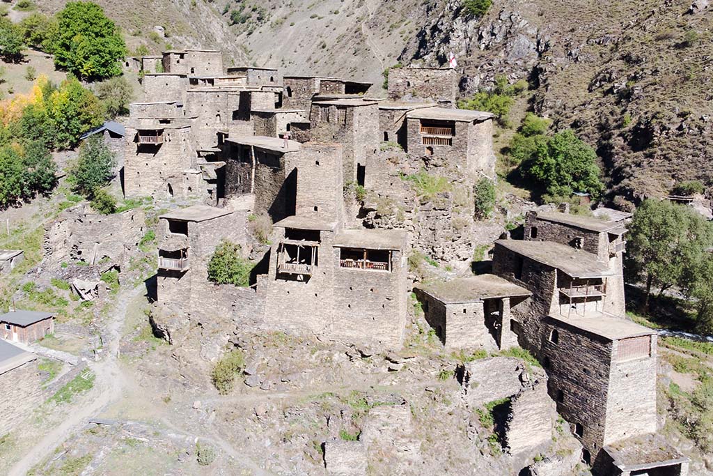
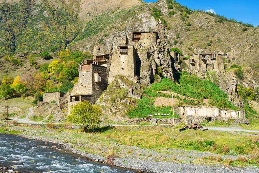
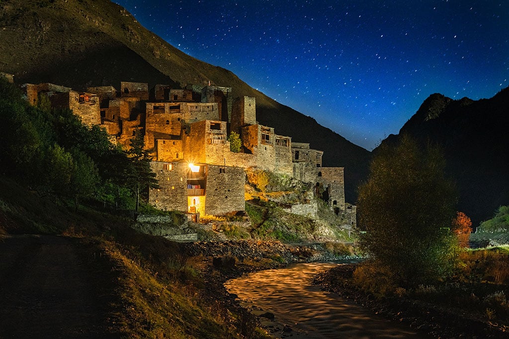
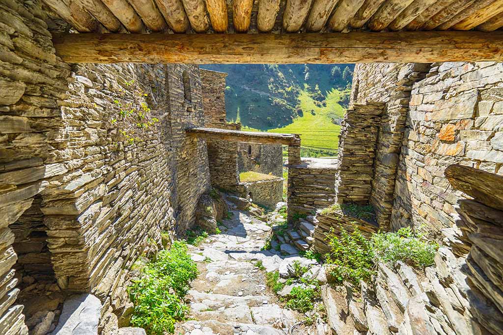
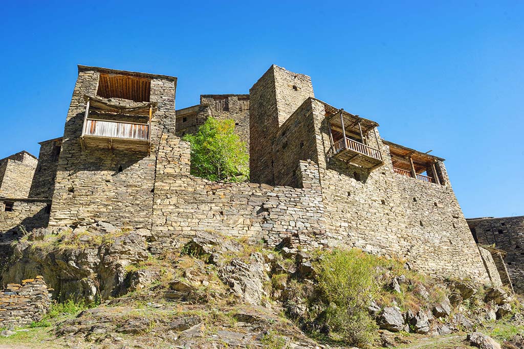
Photo Mutso
Of course, this is one of the most beautiful places in Georgia and it is worth visiting. If you do not plan multi-day trekking with overnight stays in tents, then two or three days will be enough to get to know the region.
A trip to Khevsureti will be remembered for a long time for its beautiful landscapes and the amazing culture of the hospitable smiling mountaineers.

My name is Vitaly Kibitlevsky, I am a tour guide and creator of unique quests in Batumi. If you want to walk around the city with a fascinating storyteller or plunge into an exciting adventure, write to the mail: vitkibit@gmail.com
Find out more about me and my projects here